

- RETAIL & CONSUMER
- MARKET & BEHAVIORAL INTELLIGENCE
- MOTION TRACKING
Unlocking powerful retail intelligence from customer movement data for IBM

Does proximity to an item encourage a purchase? How does time spent in front of a product affect buying decisions? These are questions retailers have chased for years. IBM had developed a 360 degree fisheye camera system capable of tracking customer movement through a store over time and needed a partner to turn that raw data into spatial insight.
Integral partnered with IBM to build the geospatial data fabric and analytical platform that made that possible. By modeling store layouts, processing movement tracking data, and connecting it to point of sale data, we gave IBM the tools to analyze how store layout, product placement, and customer behavior interact to drive purchasing decisions.

1K+
shoppers analyzed
1,000+
SKUs in the geodatabase
-
Define the decision
Retailers have long known that store layout and product placement influence purchasing behavior. But proving it with data, and using that data to make better decisions, has been far harder to achieve.
IBM’s questions were specific:
- Does proximity to an item encourage a purchase?
- Does the amount of time a customer spends in front of a product affect whether they buy it?
- How does store layout drive or discourage conversion across different product categories?
IBM had the camera technology to track customer movement through a store. What they didn’t have was a spatial framework to make that data meaningful — a way to connect movement patterns, time spent, and product location to actual sales outcomes.
The decision to solve:
How do you turn raw customer movement data into a spatial analytical environment that reveals how store layout and product placement drive purchasing decisions?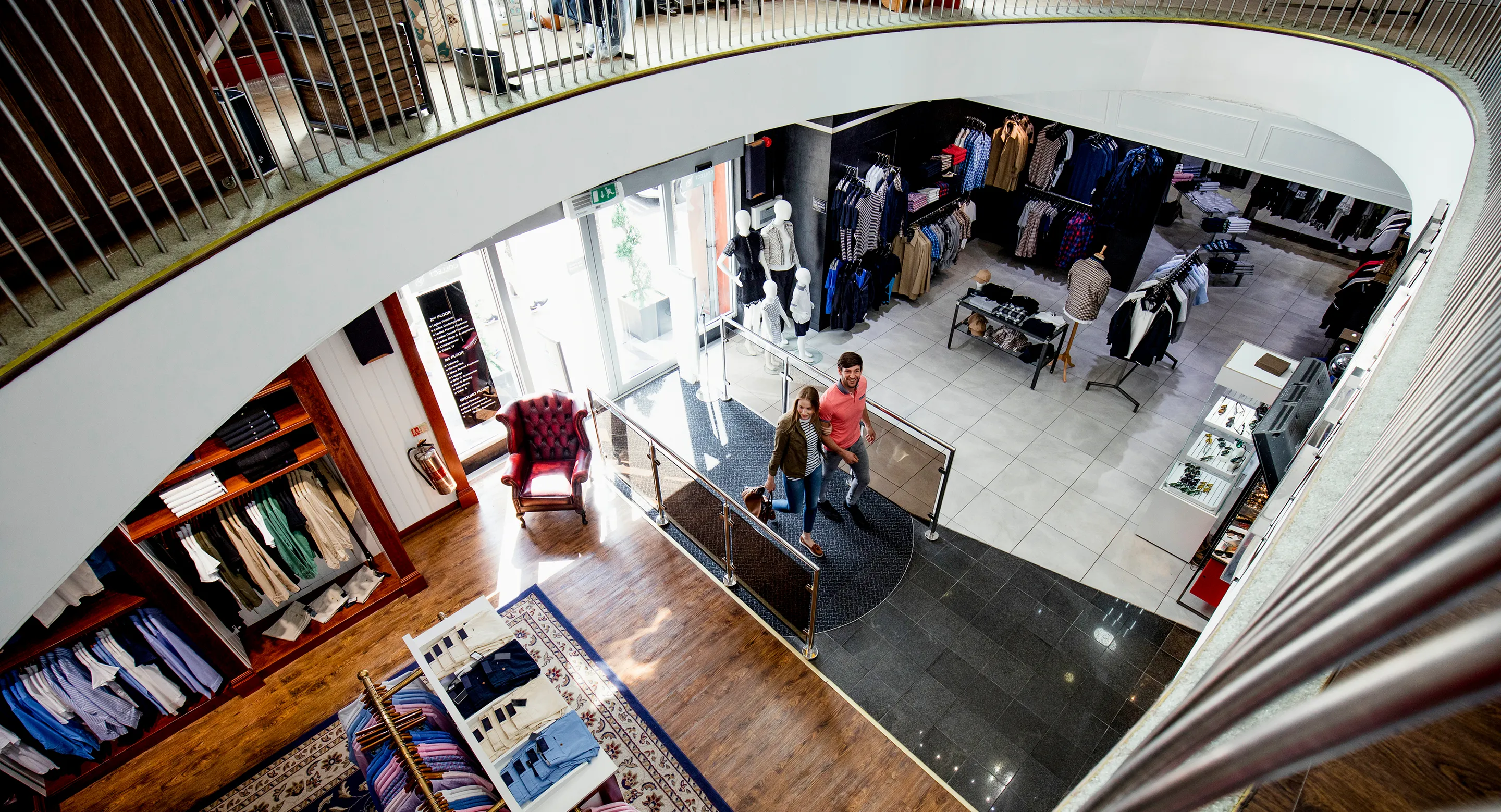
-
Design the system
Integral partnered with IBM to design a system that could bridge two previously disconnected data sources — customer movement tracked by IBM’s 360 degree fisheye camera system and product sales data from IBM’s point of sale database — into a unified spatial analytical environment.
The starting point was the store itself. Integral created a detailed geospatial data fabric of the trial store, modeling every aisle, shelf, and product location as structured spatial data. That foundation made it possible to connect where customers moved, how long they stayed, and what they ultimately purchased into one coherent analytical picture.
The system design focused on:
- Modeling the physical store environment as a precise spatial data fabric
- Processing and integrating IBM’s camera tracking data into the geospatial model
- Connecting customer movement and dwell time data to point of sale transaction records
- Enabling analysis of conversion rates, dwell time, and product proximity across the store layout
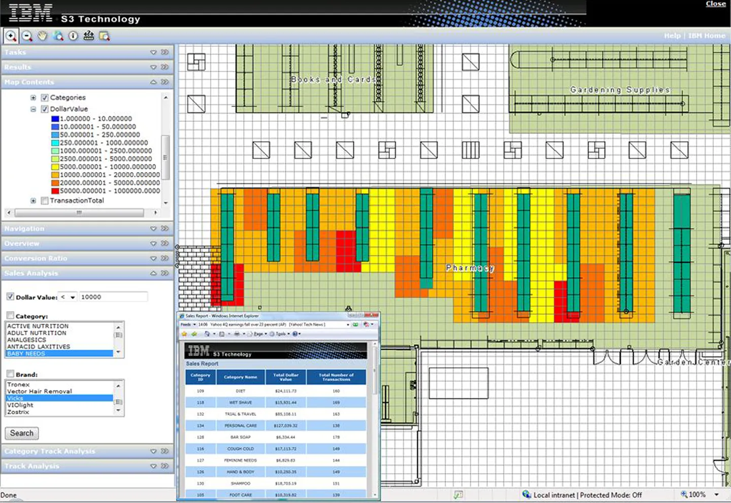
Sales performance mapped directly onto the store floor plan by category and dollar value, connecting spatial location to purchasing behavior for the first time. -
Build the platform
Integral built a spatial analytics platform purpose-built for indoor retail behavioral analysis, combining IBM’s proprietary camera tracking technology with a structured geospatial store model and point of sale data.
Core platform capabilities included a detailed geospatial data fabric of the trial store modeling every aisle, shelf, and product location. IBM’s 360 degree fisheye camera tracking data was processed and integrated into the spatial environment, enabling customer movement path visualization showing how shoppers moved through the store over time.
Dwell time analysis measured how long customers spent in front of specific products and categories, while histogram analysis compared time spent in front of products alongside actual sales data. Conversion ratio analysis connected product proximity and dwell time to purchase outcomes, all integrated with IBM’s point of sale database for sales performance comparison by category and product.
-
Deliver the insight
For the first time, IBM had a spatial framework that connected customer movement, dwell time, and purchasing behavior into a single analytical environment. The questions that retailers had chased for years could now be tested, measured, and answered with data.
The platform enabled IBM to test and analyze various methods to increase customer conversion rates, improve store layouts, and optimize product placement and presentation. Retailers could see not just where customers went, but how long they stayed, what they bought, and how proximity to a product influenced the decision to purchase it.
What Integral built for IBM was more than an analytics tool. It was proof that indoor spatial intelligence could become a practical, data-driven foundation for retail decision making.
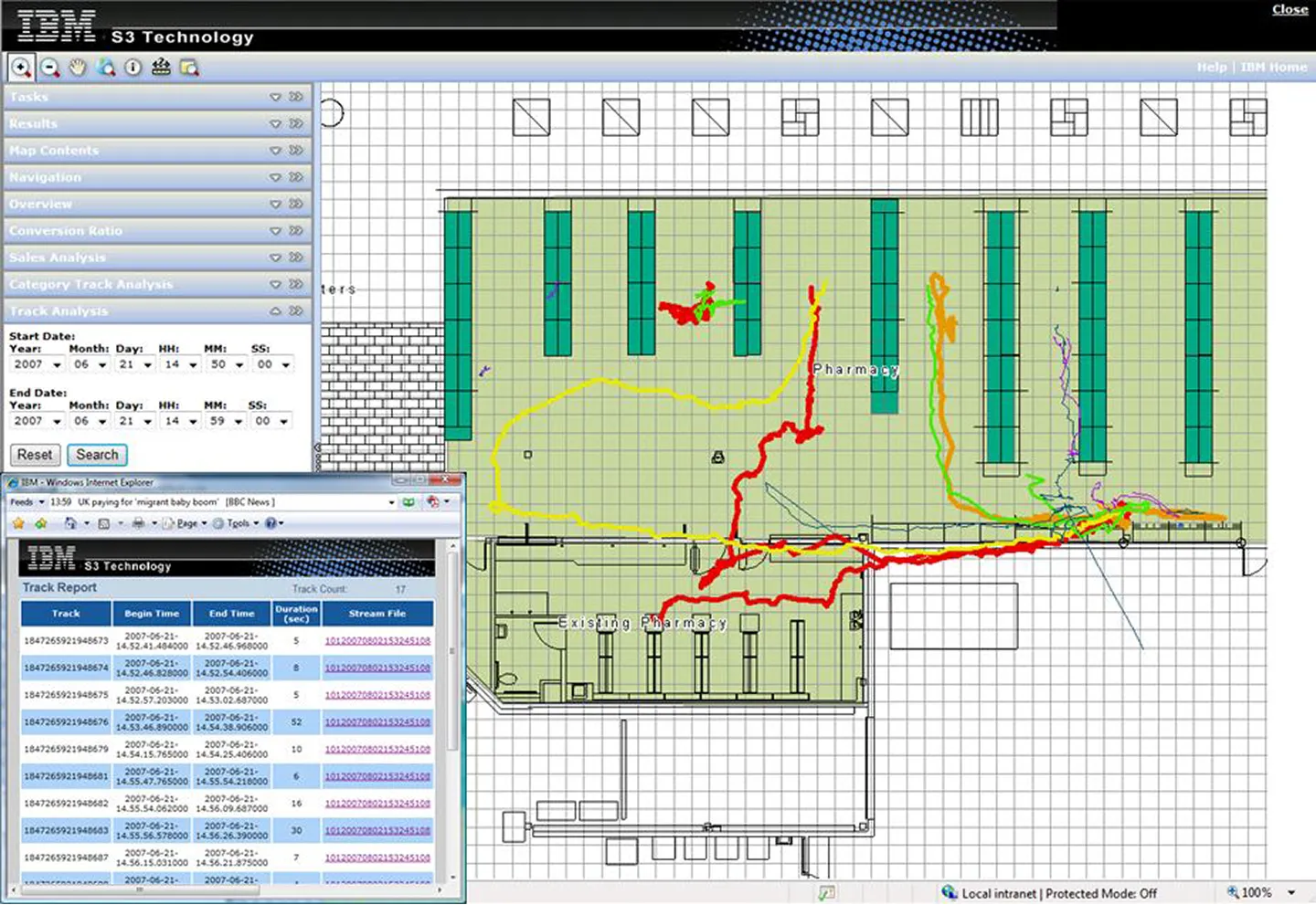
Individual customer movement paths tracked through the store over time, revealing how shoppers navigate the space and which products and areas attract the most engagement. -
Support real-world use
The IBM engagement demonstrated something the retail industry had long suspected but never been able to prove with spatial data. Customer movement, dwell time, and product placement are measurable, analyzable, and actionable.
The platform gave IBM a replicable framework for testing retail environments. A new store layout, a repositioned product category, a changed shelf configuration could each be evaluated against real customer movement and sales data rather than intuition alone.
Our collaboration with IBM served as an early proof of concept for what is now a growing field of indoor spatial analytics. The ability to connect physical space, human movement, and purchasing behavior into one analytical environment remains as relevant, if not more so, today.
Complex problems deserve purpose-built solutions.
Understanding your challenge is step one. Tell us what you're working on and discover how we can work together to figure out the right solution.