Election Monitoring
Lebanon Electoral Board
The Challenge
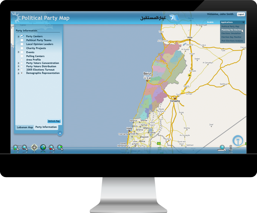
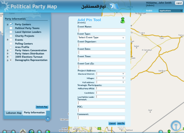
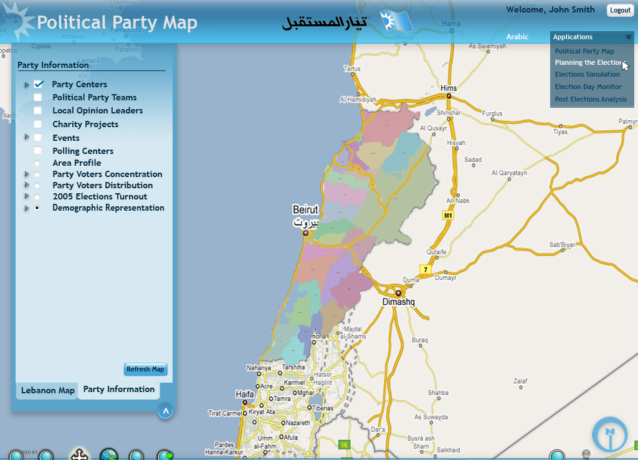
How do you get a group of supporters out to the polls? Where is the nearest polling place? What tools do you need for real-time election monitoring? In the months before the 2009 Lebanese parliamentary elections, an electoral reform coalition asked us to create a suite of tools and features that would enable all political parties to track election results and engage potential supporters.
Our Insight
Given that no geospatial data or infrastructure existed, our team packed their bags and worked morning to night in Beirut for six months, gathering information from a local perspective.
Our Approach
To create applications, we first needed to create a dataset that was accurate and detailed. We then set about creating the first geospatial maps of the country’s political districts, as well as a database of voter preferences based on handwritten logs.
Categories
- Data
- ESRI
- Geodatabase

The Results
We built a suite of applications that enabled election day monitoring over SMS, as well as provided predictive analysis based on exit polls for the networks in Beirut to use. We also created a system for political parties to identify clusters of possible support and find the best ways to transport those supporters to polling stations. Ultimately, we supported a democracy to present the results of their election to their citizens in real-time.Explore our related projects